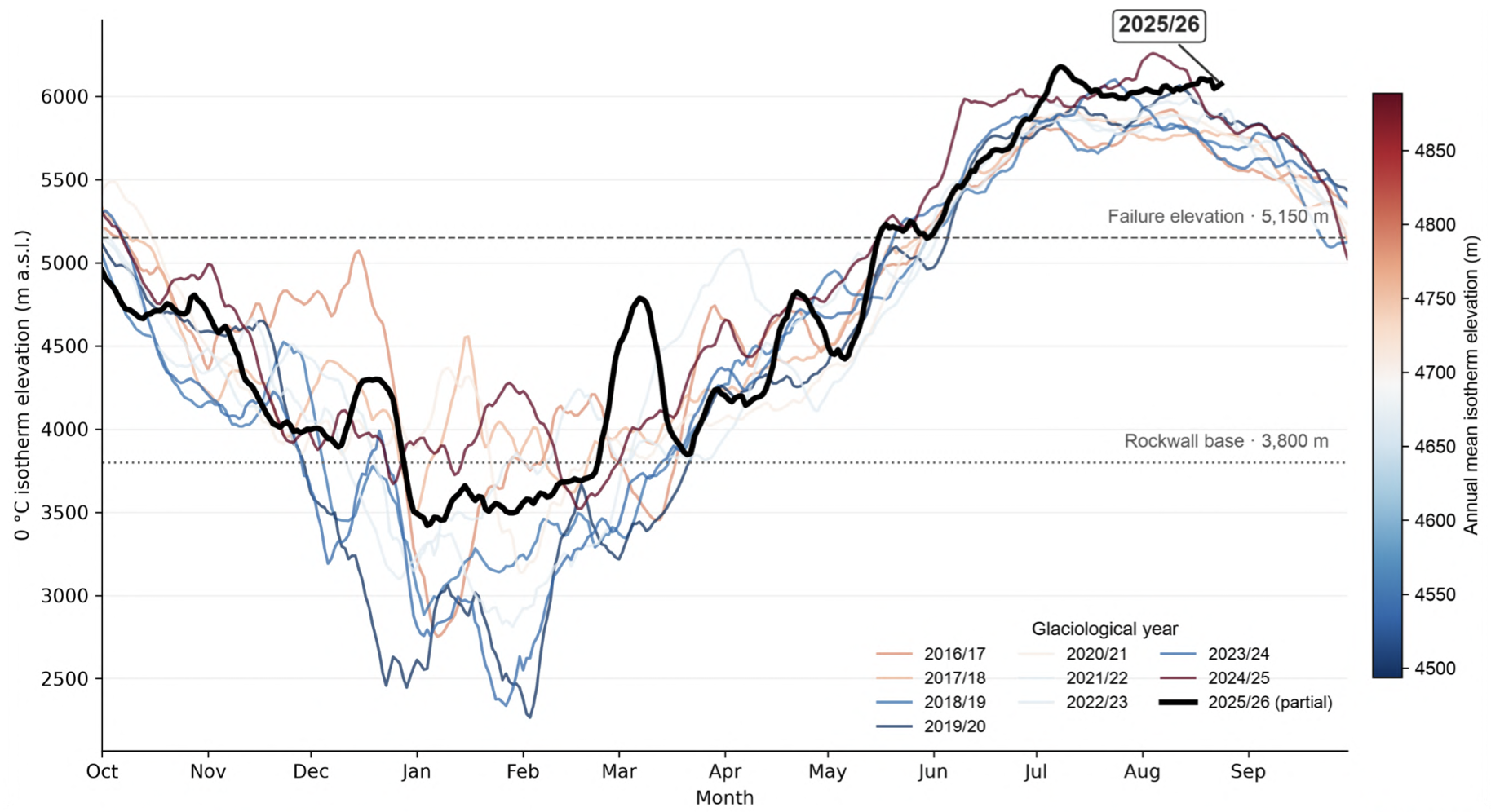
The World Weather Attribution rapid review last week of climate models based on weather observations and existing geological research reinforced what scientists have long argued: climate change is altering the physical conditions of the mountains.
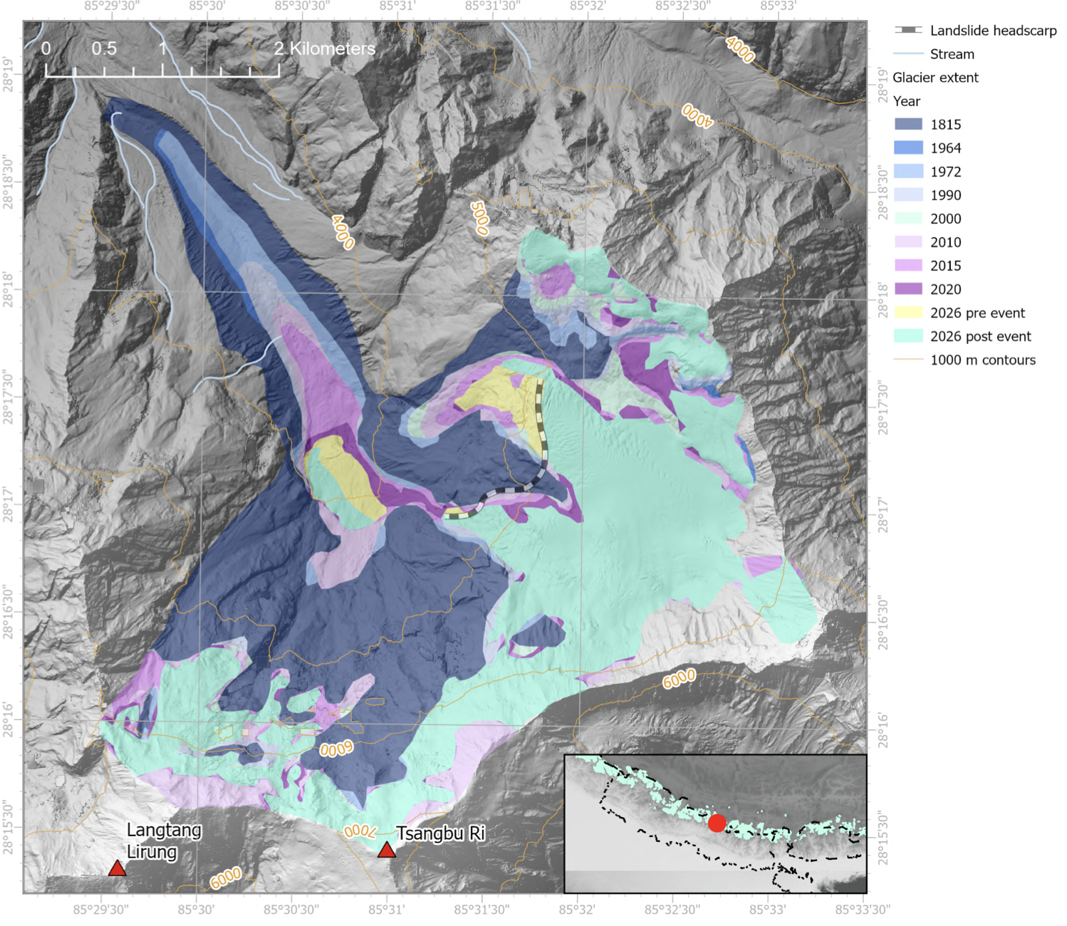
A combination of geological and hydrological processes in the cryosphere caused the Bhote Kosi-Trisuli disaster. A warmer atmosphere, shifting rainfall and snowfall patterns, glacier and snow loss, and permafrost degradation can affect slope stability and the movement of water and sediment.
These changes interact with geology and topography and increase the likelihood or magnitude of cascading hazards.
The IPCC Fourth Assessment Report in 2007 described the Himalaya as a scientific ‘white spot’ because of limited hydro-meteorological stations and peer-reviewed research.
Two decades later, the region remains poorly understood. We know little about how permafrost dynamics are changing, snowfall and rainfall patterns are shifting, rain is reaching higher elevations, and rising temperatures affect snow and glaciers.
We also lack understanding of how these changes interact with the mountain slopes and river hydrology. The rivers are not what they were a century ago, their flows altered by dams, diversions, roads, settlements and infrastructure.
As climate and physical conditions change, we must ask what happens to dams and reservoirs when sediment loads increase exponentially? How should infrastructure be operated when the timing and intensity of floods shift? What happens to river-sharing when the hydrology on which they were based changes?
AI ANALYSIS
Monitoring and research in the Himalaya are too limited for the scale and complexity of the changes underway. Advanced remote sensing can identify surface deformation across large and difficult-to-reach areas. AI can analyse large volumes of data and detect patterns more easily.
But technology alone is not enough. Satellites can show that a surface is moving, they cannot by themselves explain what is happening beneath it. Its value depends on institutions, skilled people, field observations, and sustained resources. Ground-based research remains essential. We need long-term field research, ground and satellite monitoring, better geological and cryosphere data, early-warning systems, and institutions capable of interpreting information and communicating warnings in time.
Scientific knowledge becomes useful only when it reaches those who manage risks and those who may be exposed to them. This means thinking about redundancy, particularly in the last mile. A warning system is only as strong as the people and institutions that can act on it (page 5).
Getting to such a future requires investment and a different way of thinking about public infrastructure. The larger question is not only how we adapt to climate change, but what kind of development we pursue in a changing physical environment. For decades, development has often meant building more roads, expanding settlements, increasing energy production, connecting remote regions, and making more land accessible.
We have continued to build (and after damage, rebuild) without adequately heeding heightened risks created by the intensity of extremes, compounding exposure, and vulnerability. ‘Build back better’ has too often remained rhetoric rather than practice.
Yet development can also increase exposure when infrastructure and settlements are placed in unstable terrain or when natural systems that regulate water are altered.
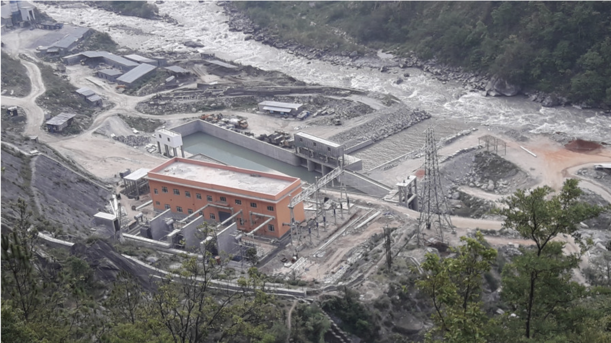
Roads can disturb slopes, excavation changes drainage. River engineering alters sediment movement. Hydropower plants concentrate people and infrastructure in narrow valleys. Urbanisation places people and assets in areas exposed to floods, landslides and other hazards.
An infrastructure project that appeared reasonably safe under past climatic and geological conditions may face different risks in future ones. What was once considered an extreme event may no longer remain outside the range of experience. This does not mean every hazard is caused by climate change, it means the assumptions used to define risk can no longer be treated as permanent.
Adaptation needs to be understood more broadly. It cannot simply mean protecting the existing development model from a changing climate. Risk needs to become part of the basic design question, rather than something added after a project has been planned. Development must take account of geological processes, changing hydrology, ecosystems, climate projections and the limits of what can safely be built in particular places.
The real question is what these changes mean for development, disaster risk reduction and people’s well-being in Nepal and across the Himalayan region. Climate change also brings the question of whether people will continue to have safe land for housing, reliable food production, drinking water, energy, and access to essential services as the physical environment changes.
The global climate signal is becoming harder to ignore. The growth in global CO₂ emissions has slowed, but atmospheric CO₂ concentration continues to rise. Slowing the growth of emissions is not the same as reaching net zero. The latest assessment estimates that average warming during 2016-2025 was 1.26°C above the 1850-1900 baseline, compared with about 0.93°C during 2006-2015.
Of this, 1.24°C was human-induced. The recent rate of warming should not be projected forward as a precise forecast. Annual temperatures vary, and the 2016-2025 average was influenced by exceptionally warm years, particularly 2023 and 2024. Yet the longer-term direction is clear. Global emission reductions are not occurring as envisioned by the 2015 Paris Agreement.
As per UNEP’s Emissions Gap Report 2025, current Nationally Determined Contributions and policies still place the world on a trajectory of roughly 2.3–2.5°C of warming by 2100 under full implementation, and close to 2.8°C under existing policies.
Temporary exceedance of 1.5°C is now very likely within the next decade due to insufficient emissions reductions. Limiting the magnitude and duration of that exceedance will require accelerated action, with most responsibility falling on countries of the Global North given their historically high cumulative emissions.
Exceeding 1.5°C will intensify extreme weather events and risks of irreversible tipping points. This is where the 2026 disaster becomes more than another event to be managed. At the national and community levels, the question is how people will live with risks that are already emerging and those that cannot be avoided.
A safer development pathway will require better understanding of hazards, protection of natural ecosystems that buffer risk, risk-based placement of infrastructure, stronger communities and local institutions, and enforceable rules. It will also require redundancy so that the failure of one road, institution, service or communication channel does not cascade into a larger disaster, despite the added cost.
The lesson of the 2026 catastrophe is that the physical and climatic conditions under which we plan development are changing. Many development practices still rely on assumptions drawn from a more stable climate past. The task is not simply to use yesterday’s development approach to adapt to tomorrow’s climate, it is to rethink the development pathway itself.
Development has to work with the changing climate, mountains, rivers, and ecosystems. Countries in the Himalayan regions also need to cooperate. Acting alone, we risk losing the game. Acting together, as all countries united, we stand a fair chance of winning the battle.
Ajaya Dixit is a water and climate change analyst and former Executive Director of Kathmandu-based Institute of Social and Environmental Transition Nepal.
Monirul Mirza is currently with Climate Lab, Department of Physical and Environmental Sciences, University of Toronto Scarborough, Canada.