So far, most of the analysis of the trigger that set off a cascade of events in this week’s Himalayan flood catastrophe had been based on images from remote sensing satellites.
But new drone video and photos have emerged from Chinese researchers that provide indications of the sequence of events on the north face of Langtang Lirung on that fateful morning of 26 August.
The priority for now must be in search, rescue and rehabilitation of the 100,000 survivors and homeless from the disaster in Nepal. As of Saturday evening, 675 bodies had been found and 2,498 people have been listed as missing. There are another 500 or so missing on the Chinese side, among them many foreign nationals.
Time is running out as those trapped in collapsed building and hydropower plant tunnels wait for rescue. Despite the Nepal government’s best efforts, the scale of the disaster is overwhelming, and more specialised rescue teams have now arrived from India, China, and Korea.
Scientists and researchers around the world are looking at most recent drone footage for clues about what happened so that they can find indications of similar events in the Himalaya in future.
LIVE ON CAMERA
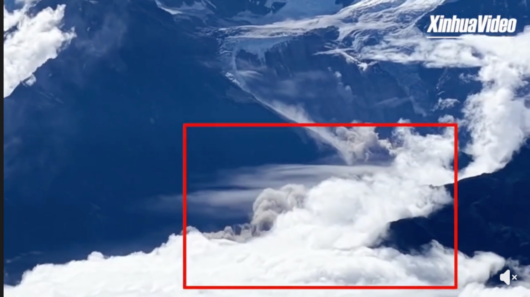
A drone operator based at a mountaintop radar station in China seems to have inadvertently recorded a video of the ice-rock avalanche as it happened 5,000m on the mountains across the river on the Nepal side (see video).
The drone operators also films himself amidst a spectacular backdrop to the south of Langtang Lirung (7,234m) and Kimshum (6,781m) peaks in Nepal on a nearly cloud-free morning. Suddenly, there is a white stream coming down the mountain and billowing brown dust cloud rising up from the Lhende Khola Valley.
This live footage of the glacier collapse is reminiscent of the Seti flood near Pokhara in 2012 when a GoPro camera on the wingtip of a sightseeing plane accidentally recorded the rockfall from the top of Annapurna IV that set off the debris flow that killed 79 people downstream.
The live clip of the Langtang avalanche this week, and drone videos and pictures taken by Chinese researchers offer proof that the rock face bearing a hanging glacier at the end of an ice field below the summit of Langtang Lirung collapsed. This contradicts earlier theories that it was an ice mass on the glacier that failed.
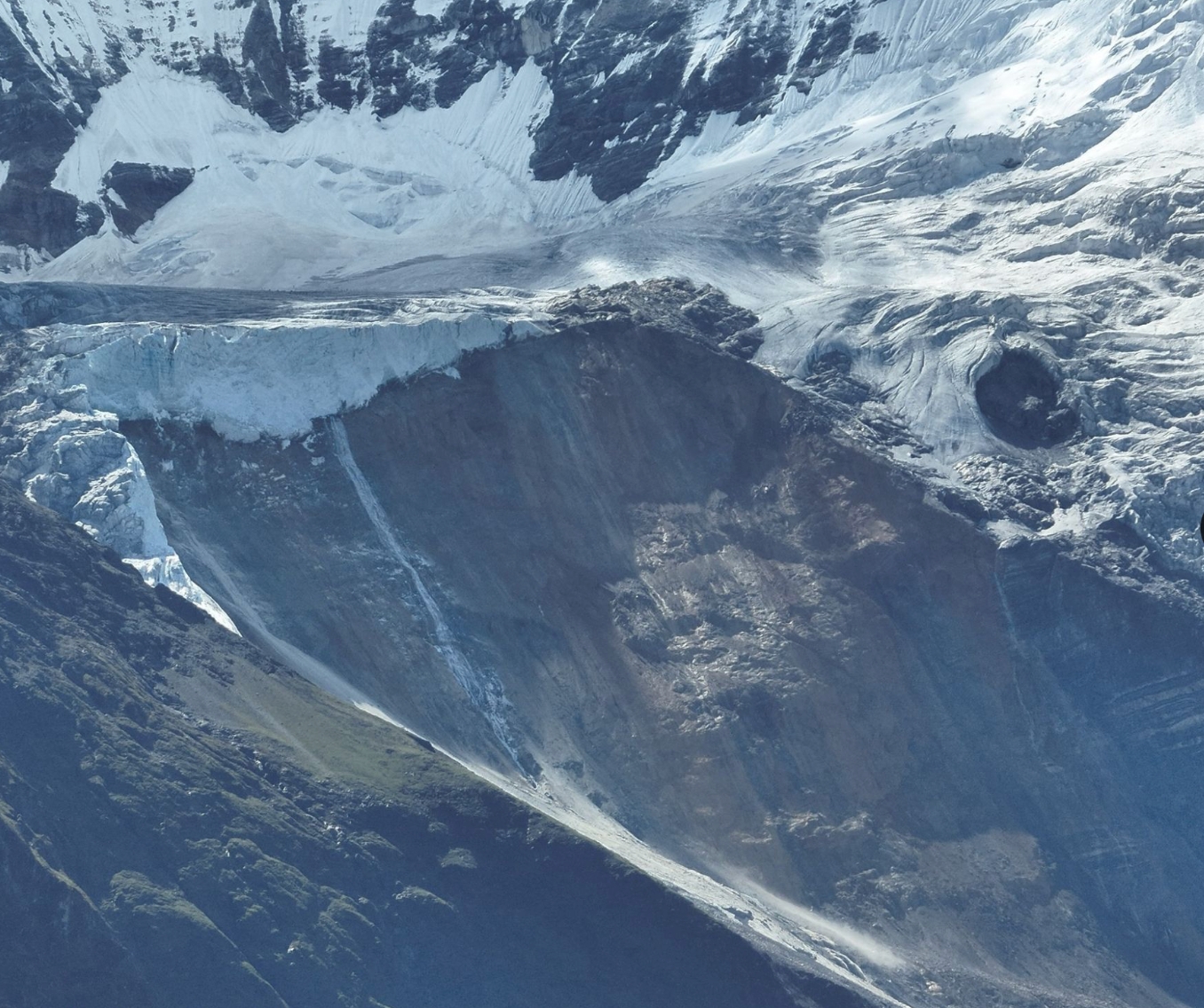
It seems the bedrock itself crumbled taking the ice above it down to the bottom of the north face, 1,500m down. The kinetic energy, friction and sheer force of 500 million tons of rock and ice pulverised and melted even as it fell, adding to the monsoon-swollen water of the Lendhe Khola, another 1,000m below.
It appears this was not so much a glacier collapse but the mountain itself falling apart. Such events have happened before on Annapurna IV (2012), Saldim Peak near Makalu (2017), or the earthquake-induced ice-rock avalanche on the other side of mountain in 2015 that buried the entire village of Langtang, killing 300 people.
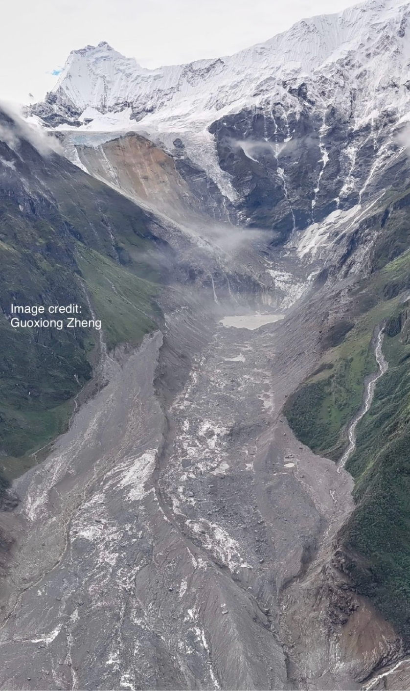
The question scientists are asking now is what made the bedrock split open this week on Lagntang’s north face. The Himalaya is the youngest and highest mountain range in the world that is seismically active and fragile. It is also not in isostatic equilibrium, which means that the peaks are becoming top heavy because its tectonic uplift overrides gravitational pull.
This process of deconstruction of the mountains could now be aided by global heating, which in turn is melting the permafrost ice that used to keep the rock faces in deep freeze. Without the frozen glue to hold the chunks of rock together, it is easier for them to break apart.
Since the Last Ice Age that ended 15,000 years ago and the Little Ice Age 600 years ago, there has been a natural process of retreat of Himalayan glaciers. Climate change has been an accelerant of this pre-existing thawing trend. The icefall on the north face of Langtang had also retreated up the mountain, exposing the rock face.
This summer, the trans-Himalaya has been one of the hottest in a decade. As the mountain heated up, permafrost in the cracks within the soft, crumbly rock band had turned into water and was seeping deep into it.
The momentum that the ice and rock mass gathered as it tumbled down the mountain was so great that when it crashed into the debris-covered glacier below, it set off a 5.2 magnitude tremor. Then it bulldozed everything down to the river, possibly blocking it temporarily.
By this time the ice had all melted into ooze, and barrelled downstream at incredible speed to engulf the 6-storey Chinese customs and immigration building in Gyirong within 20 minutes.
In the next 30 minutes the mud tsunami had reached the low valley of the Trisuli, demolishing everything in its path.The sludge even travelled upstream up the west tributary of the Trisuli on the Chinese side.
The destruction was so great that even with all their heavy equipment, it took the Chinese three days to reach what used to be their immigration and customs building.